AboutTermsPrivacyContact
 
Updating
More to Explore

More to Explore

Released: 2017-12-06
© 2019 Department of Environment, Land, Water & Planning
More to Explore - QR Code
Version 1.8.0
4+
Download on the App Store
Version 1.8.0
4+
Download on the App Store
Released: 2017-12-06
© 2019 Department of Environment, Land, Water & Planning

iPhone Screenshots

Screenshot
Screenshot
Screenshot
Screenshot

iPad Screenshots

Screenshot
Screenshot
Screenshot
Screenshot

Description

Discover Attractions
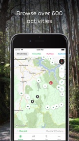
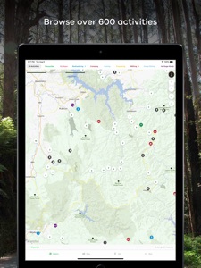
• Browse through 600+ attractions in Victoria’s State Forests using a map view or a list view.
• Search for a specific track, trail or site you’d like to visit.
• View track, trail or site details such as: when the track is open or closed, activities available at the location including difficulty levels and duration, track quality details, directions to the location, a local map, GPS guidance, download for offline use, and the ability to leave feedback.
• Share and favourite track, trails or sites. You can access your Favourites from the Favourites mode on the Explore tab.
Offline viewing for use at all times
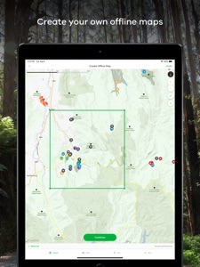
• Up to 15,000km² of offline maps of your choice can be made available for offline use when you’re out in the wild and away from an internet connection.
• When viewing a specific track, trail or site, you can tap the Download for Offline button to quickly download an area covering that location.
• All downloaded maps will be saved to your device, accessible from the More tab or the My Maps mode on the Explore tab.
Use filters to find exactly what you’re looking for
• Use the filters feature to find a specific activity or track. You can filter by track & trail type, difficulty level and duration.
• Track & trail types include: bushwalking, mountain biking, 4WDing, horse riding, and scenic driving.
• You can also filter by other map features such as Amenities, Activities and Access.
• Amenities include: toilets, BBQs, picnic tables, picnic shelters, information shelters, historic huts, viewing platforms.
• Activities include: camping, scenic driving, historic site, significant trees, fishing, horse riding, canoeing and wildlife viewing.
• Access includes: full disabled access, small caravan access, camper trailer access.
Receive updates on track news
• Opt-in to receive notifications about new tracks opening, upcoming events and more.
• Read articles about closures, safety information, news and events happening throughout the state forests.
Read up on handy tips and advice
• Get access to preparation tips, safety guidelines, vehicle access, State Forest information (responsibilities, use), dogs and battery life advice.

What's New in Version 1.8.0

Features
- My Tracks
--- Record yourself while out on an activity
--- Capture information on distance, time active and elevation
--- Pin photos to particular locations
--- Save your recording to come back and view later
General
- Various bug fixes
- Offline map stability improvements

Seller

Name

Department of Environment, Land, Water and Planning

Information

Categories

Version

1.8.0

Size

121.1 MB

Game Center

No

VPP Device Licensing

Yes

Rating

Rated: 4+

Compatibility

iOS 10.0 or later

Devices

iPhone 5s, iPhone 6, iPhone 6 Plus, iPhone 6s, iPhone 6s Plus, iPhone SE, iPhone 7, iPhone 7 Plus, iPhone 8, iPhone 8 Plus, iPhone X, iPhone XR, iPhone XS, iPhone XS Max, iPhone 11, iPhone 11 Pro, iPhone 11 Pro Max, iPhone SE (2nd generation), iPad (5th Generation) Wi-Fi, iPad (5th Generation) Wi-Fi + Cellular, iPad (6th generation) Wi-Fi, iPad (6th generation) Wi-Fi + Cellular, iPad Pro, iPad Pro (Cellular), iPad Pro (9.7-inch), iPad Pro (9.7-inch) (Cellular), iPad Pro 12.9-inch (2nd generation), iPad Pro 12.9-inch (2nd generation) Wi-Fi + Cellular, iPad Pro (10.5-inch), iPad Pro (10.5-inch) Wi-Fi + Cellular, iPad Pro (11-inch), iPad Pro (11-inch) Wi-Fi + Cellular, iPad Pro 12.9-inch (3rd generation), iPad Pro 12.9-inch (3rd generation) Wi-Fi + Cellular, iPad Air, iPad Air (Cellular), iPad Air 2, iPad Air 2 (Cellular), iPad Air (3rd generation), iPad Air (3rd generation) Wi-Fi + Cellular, iPad mini Retina, iPad mini Retina (Cellular), iPad mini 3, iPad mini 3 (Cellular), iPad mini 4, iPad mini 4 (Cellular), iPad mini (5th Generation), iPad mini (5th Generation) Wi-Fi + Cellular, iPad (7th generation) Wi-Fi, iPad Pro 11-inch (2nd generation), iPad Pro 11-inch (2nd generation) Wi-Fi + Cellular, iPad Pro 12.9-inch (4th generation), iPad Pro 12.9-inch (4th generation) Wi-Fi + Cellular, iPad Air4, iPad Air4Cellular, iPad EighthGen, iPad EighthGenCellular, iPod touch (6th Generation), iPod touch (7th generation)

Languages

English

App Store: Customer Ratings

Ratings & Reviews

4.0 of 5 (37 Ratings)

App Store: Customer Reviews

2020-06-21

Good start but ....

The More To Explore app includes information on recreation sites and trails within Victoria’s State forest, managed by the Department of Environment, Land, Water & Planning. It unfortunately doesn’t include sites/trails managed by Parks Victoria. As I am a bush walker it would be great if the department could join forces with Parks Victoria to make a more comprehensive app.
Roythedestroy
Version 1.6.0
2020-04-14

Should be for all public land sites

Needs more sites from committee of management, parksVic and local councils.
dave qwertyz
Version 1.5.0
2020-02-25

A surprise

Actually a really useful app and a great tool that works. If you’re heading to the high country this could help a lot. Very good topo maps. The other states need to follow suit
troopy89
Version 1.5.0
2020-01-04

Good

Have made use of the coordinates feature to report some fires.
Would like to see more paths if possible. Horse trails and bike paths.
Dan09834678
Version 1.5.0
2019-11-27

Awesome work!

Great start and am looking forward to many more updates.
Some features that would make my experience complete would be;
- Pre-defined region downloads based on activity or NP/SP boundaries
- Drop pins with selectable map icons, title & description
- Ability to persist and sync user data between devices
christrewin
Version 1.5.0
2019-11-26

This is what I’ve been waiting for.

Awesome maps and with the introduction of the new hunting maps, I’m stoked.
I’d happily pay for this app.
Big Dave351
Version 1.5.0
2019-01-13

Out of date maps

Downloaded it and checked my area. Anything developed in the last 7 years isn’t included on street maps. I shudder to think how out of date the bush maps are!! Update to at least the last 12 months!!
GoGro
Version 1.4.0
2018-10-01

Good resource, needs a few more features.

Would be helpful to search by dog friendly, distances, waterfalls etc. making it a digital version of the walks and riding trails PDF from the parks site.
Andrew_Snape
Version 1.3.0
2018-08-14

Mel

Great app. But recently I tried opening the app and it turns off automatically.
Gpx,,
Version 1.2
2018-08-07

Okay

In the news section, the app mentioned a bike park that opened up in La Larr Ba Gauwa Park, but they never added the location to their own maps, so you have to search using a different map app.
There must be a ton of places missing on this app when they don’t add site updates that they themselves mentioned in the news section.
Still, it is a way to find “some” places you may have never known about.
This just isn’t what i’d call a “go to” app.
KingKyle74
Version 1.2
2018-07-04

Great work

Loving the app so far. Think it will be great overtime and hope to see regular updates.
This could be exactly what I’ve been looking for in a map of Victoria
Seanois
Version 1.2
2018-04-26

Great app - just what regional states need

Fantastic app guys, really headed in the right direction. Well designed too. I do feel like there is more information that can be added because it feels pretty sparse at the moment, and focused mainly on the High Country. Also, you could add a map of public toilets and other amenities perhaps? Just an idea...
StevenDaly
Version 1.1
2018-01-08

Download it very useful

Seems like a great app can't wait till they fill out the whole map and add fishing in !
5151&$
Version 1.0